Drone Rules in Uganda’s National Parks: What’s Allowed
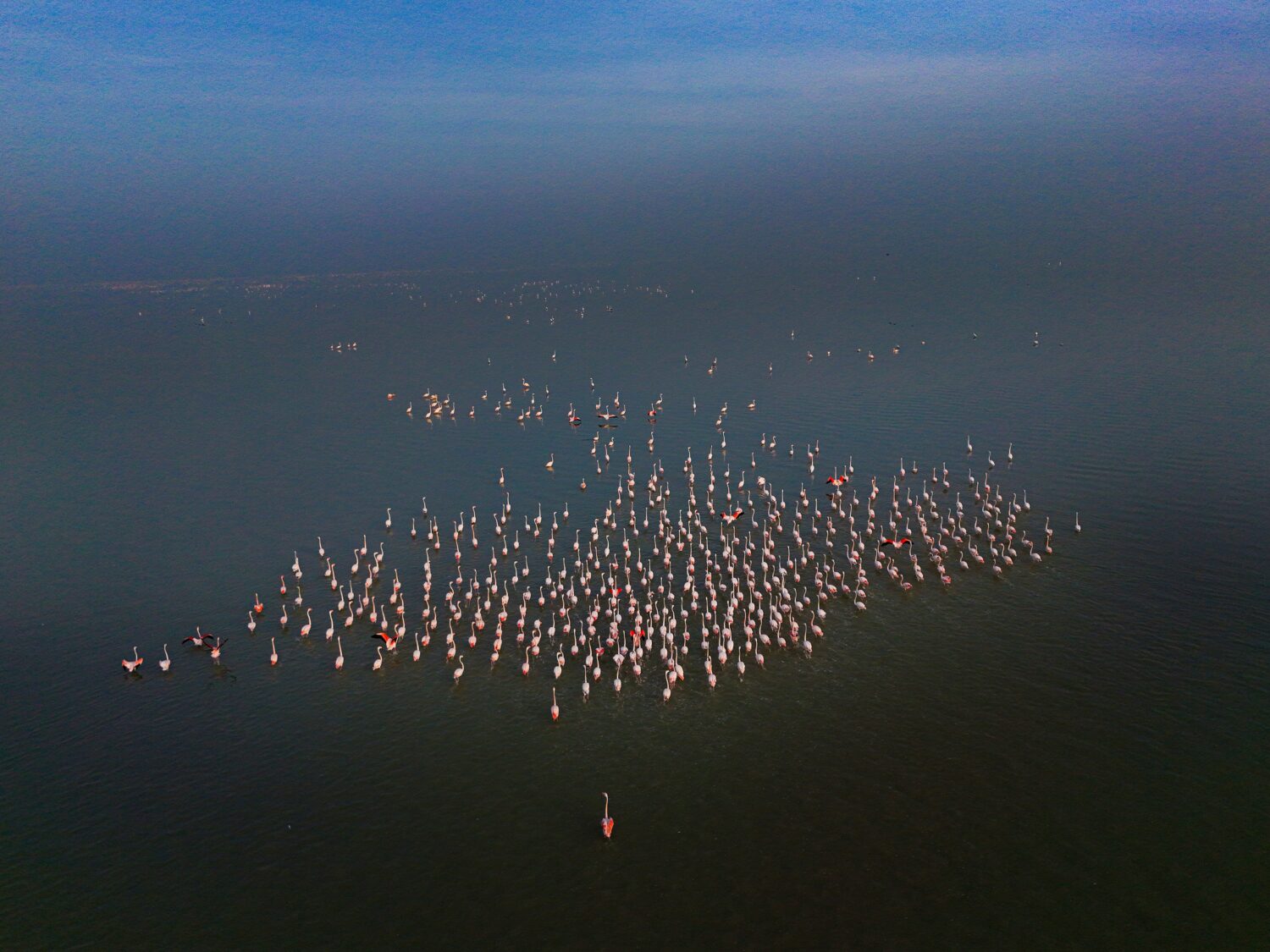
Uganda’s landscapes practically beg to be photographed from above. The Nile splitting apart at Murchison Falls, the crater lakes scattered across Queen Elizabeth National Park, the dense green canopy of Bwindi — it’s the kind of scenery that makes a traveler reach instinctively for a drone bag while packing. But before that drone makes it anywhere near a national park boundary, it’s worth understanding the drone rules in Uganda’s national parks, because they’re stricter than what most visitors expect, and the consequences of getting them wrong range from a confiscated device to a genuinely disrupted trip.
This guide lays out what’s actually permitted, what isn’t, how the permit process works for the rare traveler who needs one, and what a more realistic approach to aerial-style photography looks like for most safari visitors.
The short answer: drones are not allowed in the parks without special permission
Uganda’s national parks, including Murchison Falls, Queen Elizabeth, Kidepo Valley, and Bwindi Impenetrable Forest, are managed by the Uganda Wildlife Authority, and UWA’s default position is that recreational drone flights are prohibited inside protected areas. This isn’t a Uganda-specific quirk; it mirrors how most national park systems around the world treat drones, largely because the noise and visual disturbance they create can genuinely stress wildlife in ways that aren’t always obvious to the person holding the controller. A drone hovering near a pride of lions or a herd of elephants might look harmless from the operator’s vantage point, but the animals often experience it as a threat, and repeated disturbances of this kind can alter feeding, resting, and movement patterns over time.
For primates in particular, the restriction is even firmer. Bwindi Impenetrable Forest and Kibale National Park, home to Uganda’s mountain gorillas and chimpanzees respectively, treat drones as essentially off-limits regardless of permit status, because the acoustic stress caused by rotor noise can disrupt primate groups that conservationists have spent years habituating to human presence. So if the plan is to capture aerial footage of a gorilla family from above, that’s simply not something Uganda’s park authorities will authorize, permit or no permit.
Why the restriction exists beyond wildlife stress
Wildlife welfare is the primary reason, but it isn’t the only one. Drones have been used elsewhere in Africa by poachers to track animal movements and identify vulnerable herds, which has made wildlife authorities across the continent understandably cautious about unregulated drone activity near protected animal populations. There’s also a straightforward visitor-experience argument: part of what people pay for on a safari is the sense of being in an untouched wilderness, and the buzz of a drone overhead tends to break that atmosphere for everyone nearby, not just the operator. Layered on top of both of these is a general aviation-safety concern, since light aircraft frequently operate at low altitude over these same parks, ferrying safari guests between destinations like Murchison Falls and Kidepo, and an unregistered drone sharing that airspace creates a genuine collision risk.
What a permit actually involves, for the rare traveler who needs one
Commercial photographers, documentary crews, and researchers occasionally do need drone footage from inside a national park, and Uganda does allow for this through a formal permit process, though it’s considerably more involved than most people assume. It typically requires clearance from both the Uganda Civil Aviation Authority and the Uganda Wildlife Authority, and the CAA process alone generally takes somewhere between four weeks and three months, depending on the category of drone operation and whether security clearance from the Uganda People’s Defence Forces is required, which it often is. Applicants usually need to submit a detailed flight plan, proof of insurance, technical specifications for the drone itself, and evidence of pilot certification, and UWA charges a separate authorization fee on top of whatever the CAA requires, which recent figures suggest can run into the low hundreds of thousands of Ugandan shillings once VAT is included.
Even after approval, a UWA-supervised flight inside a park usually comes with operational conditions: flying only during daylight hours, staying within visual line of sight at all times, keeping the aircraft below roughly 400 feet above ground level, and in many cases having a park ranger physically present to intervene if wildlife shows signs of distress. For most independent travelers, none of this is remotely worth pursuing for a two-week vacation, and it’s really only commercial productions with a genuine budget and a multi-month planning window who go through the full process.
What happens if you bring a drone without a permit
Rangers at Uganda’s national park entrances are trained to look for drones during standard baggage checks, and unauthorized devices are commonly confiscated at the gate rather than simply flagged with a warning. In some cases, travelers who arrive at Entebbe International Airport with an undeclared drone have had it held at customs before they even reach a park, since Uganda’s Civil Aviation Authority introduced formal import procedures for drones a few years ago, and equipment brought in without the right documentation can be seized on arrival. None of this is designed to catch tourists out maliciously; it’s simply the practical result of a system built around commercial and research use cases, applied uniformly at the border regardless of intent.
The safest assumption for a leisure traveler is this: if a drone permit hasn’t been arranged well in advance of the trip, through the proper CAA and UWA channels, the drone shouldn’t come to Uganda’s national parks at all. It’s a far less frustrating outcome to leave it at home than to have it taken away on day one of a trip that’s meant to be memorable for entirely different reasons.
What’s still possible for aerial-style photography
None of this means aerial imagery of Uganda’s landscapes is out of reach for regular visitors; it just requires a different approach than personal drone footage. Several licensed tour operators and lodges around Murchison Falls and Queen Elizabeth have their own UWA-approved drone footage, captured under proper permits, which is sometimes available for licensing or is simply featured in their own marketing material. Light aircraft flights between parks, which many travelers already take to save time on long road transfers, offer a genuinely spectacular vantage point of the Nile, the Rift Valley escarpment, and the open plains below, all without needing any special authorization since it’s the aircraft’s own registered flight, not a personal drone.
Hot air balloon safaris, offered in a few parks in the region, provide another legitimate way to see the landscape from above, and photographers looking for a more grounded but still elevated perspective often do well with a simple zoom lens from an elevated viewpoint, of which Murchison Falls in particular has several, including the dramatic overlook near the top of the falls itself where the entire Nile forces itself through an 8-meter gap in the rock.
A note for travelers combining Uganda with other countries
Travelers building a wider East African itinerary should know that drone restrictions of this kind aren’t unique to Uganda. Kenya, Tanzania, and Rwanda apply broadly similar rules within their own national parks and conservation areas, generally requiring permits for any drone use and prohibiting it outright near primate habitats and other sensitive wildlife zones. If a trip includes a stop in Rwanda for gorilla trekking or a Kenyan safari extension, it’s worth checking each country’s specific drone regulations separately rather than assuming a permit obtained in one place carries over to another, since it doesn’t.
Planning a drone-free but still spectacular Murchison Falls trip
The good news for most visitors is that Murchison Falls doesn’t need aerial photography to be visually striking. The falls themselves, the boat cruise along the Nile toward the base of the cascade, the game drives across the park’s northern game-viewing circuit, and the chance to see elephants, giraffes, and lions against that backdrop already deliver the kind of imagery people travel for. If landscape photography is a priority for your trip, our team can help build an itinerary around the best vantage points and light conditions, including early-morning boat departures when the falls catch the sun at their most dramatic angle.
If you’re planning a visit and want guidance on what to bring, what to leave behind, and how to make the most of the park’s viewpoints without running into any permit headaches, get in touch through our contact page, or take a look at our Murchison Falls safari packages for itineraries that already build in the best photography opportunities the park has to offer. For travelers weighing up whether to add other parks to the trip, our Uganda safari tours page covers how Murchison Falls pairs well with destinations like Kidepo Valley and Queen Elizabeth National Park, both of which carry the same drone restrictions but offer their own standout photography spots on the ground.
The bottom line
Uganda’s national parks are protected precisely because they’ve managed to stay wild, and that’s part of what makes them worth visiting in the first place. The drone restrictions that can feel like an inconvenience when packing are the same rules helping keep elephants unbothered by aircraft noise and gorilla families undisturbed in their forest habitat. For the vast majority of travelers, leaving the drone at home and relying on a good zoom lens, a scenic light aircraft transfer, or simply the view from a boat on the Nile will capture just as memorable a record of the trip, without any risk of it being confiscated at the gate.